Technical Services
Aerial Services
Percheron’s team of FAA Licensed UAS pilots, combined with our Land Surveying Department’s full suite of traditional surveying services and Licensed Surveyors, offer a unique opportunity to integrate aerial and survey quality deliverables to our clients. From mission planning to raw collection, post-processing to QA/QC, and final deliverables, we do it all in-house!
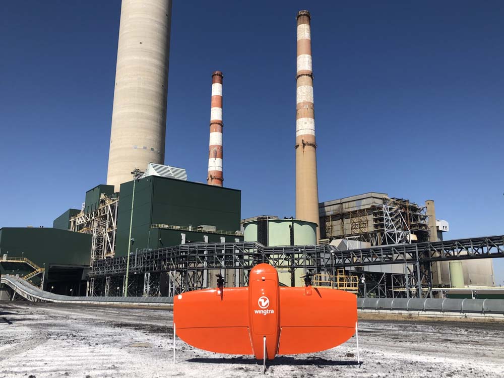


Our team can more efficiently and accurately capture data to give you complete insight into your facilities, pipelines, electric transmission lines, or roadways. Our state-of-the-art fleet is capable of flying lower and employs higher resolution sensors for video, still images, and LiDAR imagery compared to traditional manned aerial options.
In many states across the US, aerial imagery, mapping, and even GIS are considered surveying, and only licensed survey companies can legally produce these deliverables. Percheron’s position as an integrated services company with survey licenses nationwide allows us to execute the work efficiently and legally.
By combining UAS technology and services with our full-service Land Surveying Department, Percheron provides industry-leading services to the pipeline, E&P, electrical T&D, solar, wind, cellular, federal/state/local agencies, and real estate development companies. For close-up inspections and surveys of fixed assets such as power and electrical infrastructure, cell towers, and facilities, Percheron’s UAS team can provide detailed deliverables faster and safer than traditional methods.
Recent Percheron UAS Regulatory Achievements
2023
2023
FAA Non-Geographically Constrained BVLOS Performance-Based Approval
- Approved to conduct BVLOS operations anywhere in Class G airspace in the United States if the operations follow the parameters set in the wavier.
- Received a total of 3 non-geo BVLOS waivers with multiple aircraft to bring our total BVLOS waiver count to 4, leading the industry in BVLOS waivers.
2022
2022
FAA BVLOS Approval - Beyond Visual Line Of Site
- FAA geographically constrained waiver for exploratory project in West Virginia
FAA COA (Certificate of Authorization)
- Authorization to fly in military airspace
FAA, Department of Homeland Security, TSA Airline-Marshal Service, and Secret Service Approval
- Authorized to fly in Washington, DC FRZ (Federally Restricted Zone), “White House Airspace”
Percheron's licensed UAS and Survey Team can provide:
- Traditional Photogrammetry
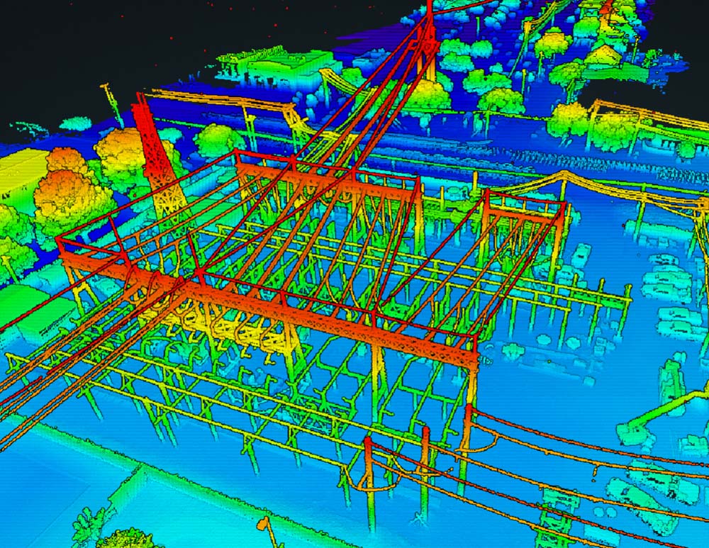
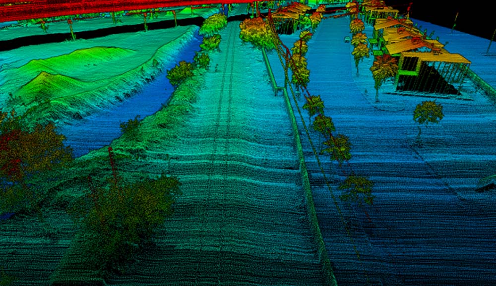
- Airborne LiDAR
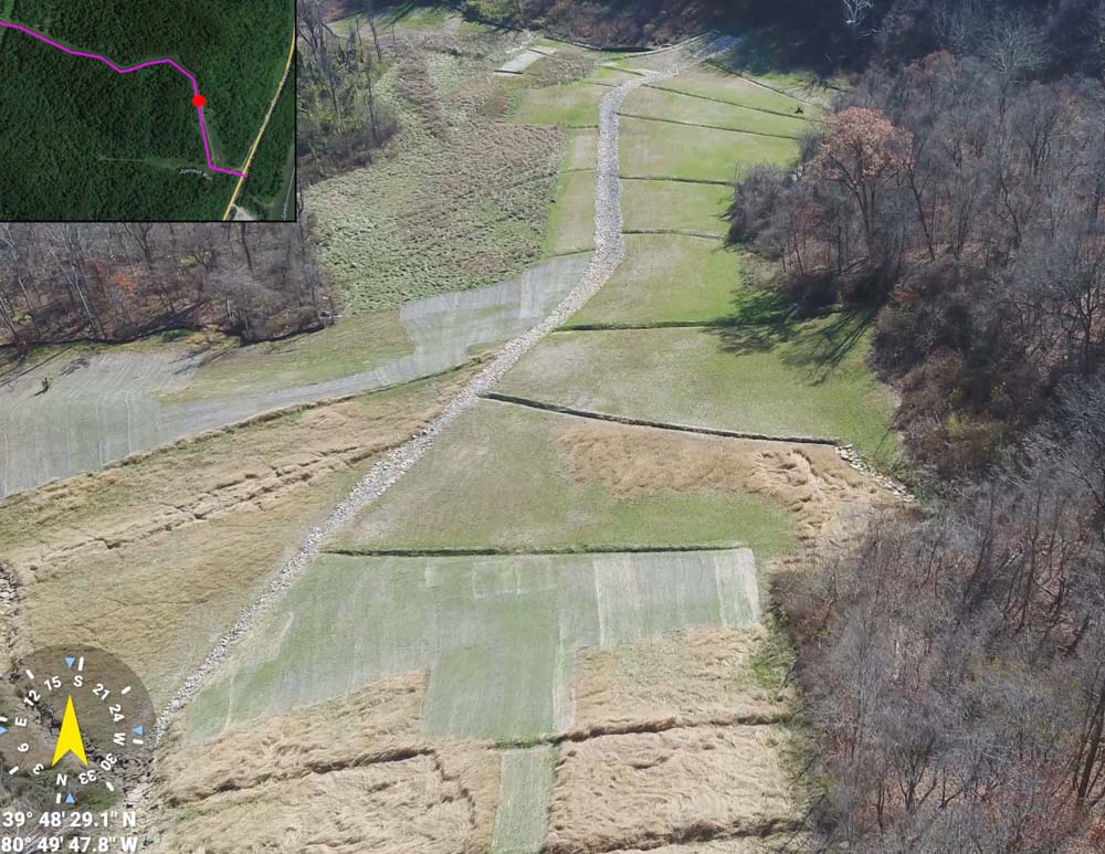
- Airborne Topographic Surveys
- Terrestrial LiDAR/Laser Scanning Surveys
- Mobile Mapping/LiDAR Surveys
- Large- and Small-Scale Volumetric Surveys
- Route Selection Assistance
- PHMSA/Regulatory Surveys
- Tank/Facility Documentation Surveys
- Aerial Reclamation Investigation and Survey Support
- UAS Equipment Feasibility and Case Studies
- UAS BVLOS and Sensitive COA Projects
- Blue/Green/NDAA compliant data collection available
- Aerial Photo/Video Documentation
- Linear Corridor/ROW/Site Inspection
- Construction Monitoring
- Emergency and Disaster Response
- Civil Infrastructure Documentation
- Environmental Conditions Documentation
- Asset Documentation
- Pre- and Post-Construction Assessments
- Wireless Infrastructure Inspection
- Thermal Inspection
- Leak and Failure Detection
- Multi and Hyperspectral Data Acquisition
Client Testimonies
Percheron worked closely with us to fly drone overflights of our terminal assets. They flew the first asset on a "proof of concept" basis and we were able to view and discuss the images , detail and resolution of both still and moving images later the same day. Percheron quoted the entire portfolio of assets from Washington DC to South Florida to Texas. The portable drone equipment was high quality and the two pilots / techs travelling to our sites paid strictest attention to all HSE requirements and FAA regulations. Finally, Percheron delivered the total project with electronic images labelled clearly by location / equipment or tank type/ number / and significant metadata. I appreciate their professionalism and would use their services again.
Project Manager
International Oil Company