Survey
Successful surveying projects depend on accuracy, consistency, and reliable results. Percheron is one of the few names in the field that has the capabilities to make it happen. Our employees are licensed experts who not only represent a vast amount of industry knowledge but they also work to understand your specific business and project needs.
From right-of-way acquisition surveys to complex plant surveys, we do it all to ensure your project demands are consistently met. And because we employ extensive quality assurance processes and utilize the industry’s leading software and technology, we’re able to deliver superior results—even when deadlines are tight.
At Percheron, we utilize the latest technology, equipment, and software to help deliver superior results. Where others might cut corners, we continually invest in the most current resources available to the industry—such as Trimble RTK Global Positioning Systems and unmanned aerial systems. In addition, our technicians are experienced in the preparation of drawings in AutoCAD™, Skyline™ Sheet Generating software, and GIS. Our field and office staff are also able to prepare digital terrain models and right-of-way maps on difficult schedules utilizing our automated software.
Percheron professionals also excel in managing the acquisition of high-resolution airborne laser mapping (LIDAR – Light Detection and Ranging) and aerial photogrammetric mapping for large projects.
Land Administration
Percheron has a fully staffed Land Administration Department (“LAD”) that works from our centralized office in Katy, Texas. Our LAD group works in tandem with our right of way agents, title abstractors, surveyors, and GIS to generate documents, send mass mailouts, manage data, and record documents in the applicable county records.
We set high expectations for our team to provide quality deliverables. LAD can control the work product and supervise the work even if the document specialist is in the field. Our teams’ refined processes ensure consistency and efficiency for your projects. In addition, we customize those processes to serve each client’s specific needs and expectations for project success. Our cutting-edge processes are established as best industry practices for our office, Percheron, and clients.
Percheron’s Land Administration Department has streamlined the document and check request process. With the aid of IT, LAD created an app for requesting documents to be generated and request checks processed through the department, along with any other agent request.
Renewable Natural Gas
With a full suite of integrated services, our team can provide comprehensive project management from initial feasibility study, through right of way & environmental permit acquisition, detail design, and construction. Our team has over 17,000 miles of linear experience that provide you with expertise no matter how large and complex the project becomes. Our service include:
Feasibility Study:
- Project Budgeting
- Material Lists, Specifications and Bid Documents
- Construction Job Showing, Bid Evaluation
- Preliminary Routing
- Line List & Permit Matrix
- TIC Estimate
- Environmental Desktop
- Analysis
- Stakeholder Engagement Planning
- Wetland Delineations
- Endangered Species Field Survey
- Archaeological Field Survey and Report
- Pipeline Detail Design
- Facility Design
ROW & Environmental Permit Acquisition, Detail Design
- Constructibility Report
- Preliminary Pipeline Design
- Preliminary Title & LTCs
- Survey Permission & Support
- Deed Plots, Boundary
- Analysis & Centerline Survey
- Negotiations
- Plat, Permit, Alignment Sheet, Construction Detail Production
- Environmental Permitting
Construction
- Pre-Construction Staking
- Aerial Inspections
- As-Built Alignment Sheets & Data Delivery
- Environmental Consultation & Construction Support
- Job Book Description
- Final File & Data Transfers
GIS
Our experienced and knowledgeable team of GIS professionals are here for all your geospatial needs. The department provides an integral component to our project planning, design and construction. Our services can satisfy a broad range of needs from varying entities and across multiple industries utilizing the latest industry-leading ESRI ArcGIS Software.
Webmap Applications:
- GRID – Utilizing the ESRI ArcGIS Online Webmap applications in combination with our database and reporting tools we can provide a one-stop-shop for viewing, tracking, and reporting on your project.
- ArcGIS Collector – Custom schema for your specific project in a file Geodatabase that can be built real-time in the field leveraging the collector application you can track project progress as it’s collected and easily convert the data into GIS deliverables.
- Google Earth – A often popular file format, KMZ/KML files are used in the field that GIS can ingest to create customized versions to display embedded images, custom attribution, and symbology to make your project shine.
Data Management:
- Percheron GIS can handle your data management needs with decades of combined experience. From an Enterprise-style multi-user GIS editable in AGOL with a recorded username/date/time logs in a hosted feature service to our customizable database application, we have the tools to suit your project. ArcGIS Online collaboration groups for data sharing cut down on emails and data silos. Data layers from the Webmap can be extracted and exported directly with a creator-level license.
- From initial tract load in CityVerse to get your project up and running in lightning-fast time, to tract numbering, reroute processing, title, survey spatial updates, and change tracking, we have you covered.
- Data QA/QC using topology rules to identify and eliminate gaps and overlaps.
- CityVerse database allows for tracking of multiple acquisition types on one property to avoid redundancy and countless hours wasted updating the same information repeatedly.
Cartography:
- Static maps – PDF Maps, Plotter maps, Permit Mapbooks, Map Series (Mapbooks) for linear projects, we can make a customized map to suit your project's specific needs.
- Preliminary Exhibits – aka Landowner Sketches – Percheron GIS can generate these customized PDF maps to get in front of your landowner for survey and acquisition in a fraction of the time utilizing data-driven pages to generate 100’s of exhibits in short order.
GIS Analysis
- Disturbance modeling – utilizing a lidar dataset or DEM and converting to a vector dataset to extract slope data and applying to create an easement along the road at a predefined distance that fluctuates based on grade.
- Siting
- Routing
- Proximity analysis – (distance from line to point), intersections, unions, dissolves, buffers, spatial joins, per tract lengths & acreages, etc.
Route Selection:
- Utilizing industry-leading 3rd party Pivvot software, Percheron GIS conducts route analysis and generates route options. Using 100’s of public and private data layers for weighted analysis, we find the most suitable route to minimize costly reroutes.
Site Suitability Analysis:
- Utilizing industry-leading Pivvot software Percheron GIS can conduct site placement review for you based upon factors such as:
- Slope (i.e. less than 10% grade)
- Oil/Gas set back
- Wetlands
- Proximity to Roads
- Floodplain
- Airports
- Powerlines
- Land Use/Land Cover
Automation:
- Utilizing python to look for the most efficient workflows
- Data-driven pages for Mapbook and preliminary exhibit creation
- Python scripts to link the tabular data from the CityVerse database to the GRID Webmap App
Data Conversion
- Taking PDF maps and converting them into vector datasets using georeferencing.
- Converting raster into a vector to run advanced analysis using ArcGIS geoprocessing tools for datasets such as slope, land use, land cover, DEM.
- Converting between different data types – KML, KMZ, Shapefile, File Geodatabase Feature classes, DWG, DGN, etc.
Digitization
- Plot metes and bounds of tract or easements from a deed or conveyance into projected vector polygons with requested schema.
- Digitize based on static PDF maps into vector datasets.
Survey Technology
By Utilizing Leading-Edge Software, Equipment, and Technologies—Percheron Helps Ensure Accuracy, Efficiency, and Greater Project Precision.
Our survey team utilizes several industry-standard equipment platforms, software suites, and tools to execute projects, including Autodesk AEC Design Suite, BlueSky, Global Mapper, Forefront Design Specialist - Plat Mapper, etc. We also use several in-house customized tools to help automate workflows; these tools cover a wide spectrum of survey services and deliverables.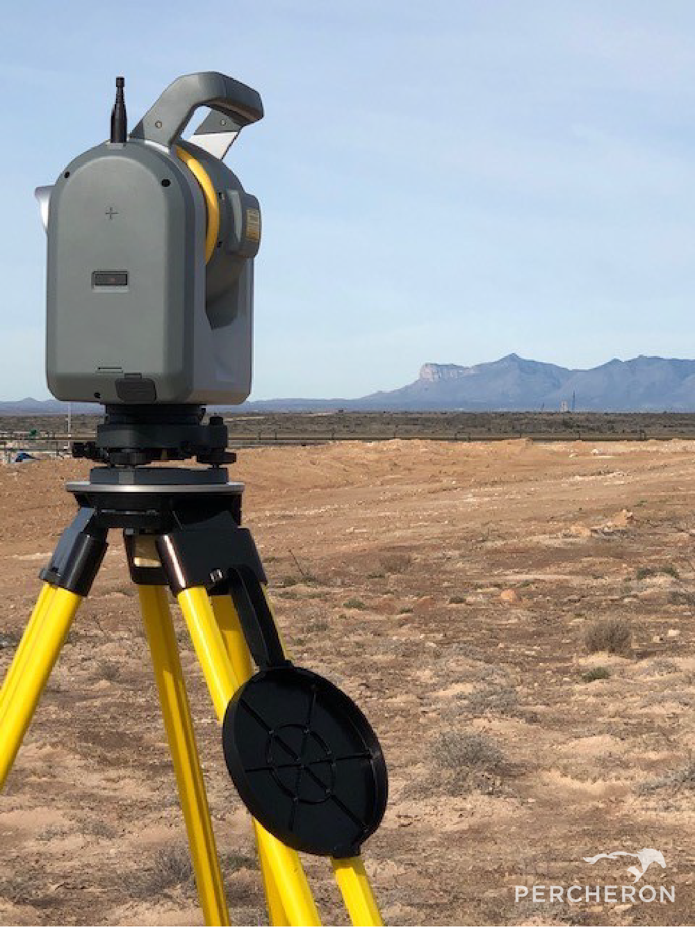
- Field Crews: Percheron field crews are outfitted with state-of-the-art equipment, including Trimble model R10-12 receivers, Radios Detection RD8100 pipeline locators, Reflectorless total stations, and all other relevant equipment to provide the full range of field services. We have several terrestrial scanning capable crews outfitted with the latest laser scanners and hybrid camera scanner setups and dedicated UAV crews to capture all aerial survey and inspection needs.
- UAS and Scanning: Percheron's Aerial Imagery team utilizes industry-standard software suites depending on the application, including Pix4D Capture/Cloud//Mapper/Survey/and Inspect, Trimble Business Center, Bentley MicroStation and Terrasolid, Global Mapper LiDAR, Trimble RealWorks. Percheron uses a wide range of sUAS platforms and manufacturers based on client needs, including quad and hex copters as well as traditional fix-wing UAVs and VTOLs. We also use Riegl and Phoenix aerial LiDAR sensors, full-frame Sony RGB cameras, 200x zoom inspection cameras, FLIR thermal cameras, and SlantRange and MicaSense multispectral, etc.

- Mapping team: Our mapping team utilizes a variety of programs to ensure the highest quality deliverables to each of our clients.
- Trimble Business Center, a Trimble field to finish Survey CAD software, helps deliver high-accuracy GNSS data.
- AutoCAD Civil3D, an Autodesk software that allows 2D & 3D design. This allows us to produce construction drawings, property plats, permits, and site-specific drawings.
- Skyline, a Bluesky software that creates accurate alignments sheets, with a Microsoft Access Database to accelerate workflow and makes changes faster.
- DASH a Bluesky software paired with a data management tool. This software includes QA/QC tools that ensure the reliability and verification of the data being collected. Orbital's Survey Module is a Bluesky software that streamlines pipeline survey management by helping to maintain quality, budget, and schedule without creating extra work for field crews. You can immediately evaluate imported data and track trends to know exactly what the survey teams are doing in the field. It allows you to set time and delivery expectations, track and assess data, and keep communication streamlined in real time.
- Plat Mapper a Forefront Design Specialist software that allows multiple plats to be cut at once for faster plat production.
- Global Mapper is a BlueMarble Software with abundant GIS tools for data creation, editing, and analysis.
- ArcMap, an Esri software with abundant GIS tools for data creation, editing, and analysis, allows the creation of quality drawing deliverables.
Land
When it comes to land management, you need service that meets your standards, your needs, and your project timeline—even in the most complex cases. That’s why Percheron only offers the most experienced professionals to handle all projects across the country. On every assignment, our dedicated experts are able to leverage a complete range of fully integrated resources to keep you on track. It’s the kind of attention to detail that keeps delays, surprises and worries out of the land management process.
Pipeline
From front-end engineering and design (FEED) through permitting, detail design and acquisitions, through complete project execution, our team can help with any phase of your pipeline project and ensure your assets are managed properly. With over 20,000 miles of linear experience across the country on some of the most complex projects, Percheron is the right partner for every phase of your project. Our experience spans beyond your traditional pipeline projects to include facilities, carbon capture sequestration, and transporting hydrogen. As the energy world continues to evolve, our team is there to take lead.
At Percheron, we believe that working as a fully integrated team is the key to success. From engineering project development to in-house title agents and field survey crews, to our senior right-of-way agents and environmental permitting specialists, all of our team members stand united with one common goal – ensuring that your project succeeds. We eliminate duplication and increase productivity through accountability so you can measure the success of your project for what matters the most...on-time and under budget. We are confident that our ability to staff any project of any size nationwide coupled with our processes and proven success, makes Percheron the only choice for your pipeline project needs.
Think Integrated
Percheron, the nations leading professional services firm, was formed out of the merger of three leading land services companies: Mason Dixon Energy, OGM Land, and Percheron in June 2012. We offer specialized expertise in engineering, land surveying, environmental, acquisitions, and title research, providing a cohesive, integrated solution for projects of any size. For some companies, the ability to organize and execute projects on a nationwide scale is just an ambition. But Percheron offers more than a promise – our record of sustained excellence and client retention proves where we’ve been and where our partnerships can go together. Headquartered in Katy, TX, our team of professionals is committed to the use of cutting-edge technology, exceptional client service, and timely and efficient project management, coast-to-coast. ![]()
So when you Think Percheron, Think Integrated!
Welcome to Percheron
We are a team of professionals who have significant experience executing any size project in nearly every state in the Lower 48. We choose to recognize our relationship with our clients as a "Partnership". Partners expect honesty, transparency, accuracy, consistency, and reliability. Our employees believe in these values, making us proud to be a part of the Percheron team.
Efficiency and accountability to achieve success motivate us. That's why we use an integrated service model. Every project requires concept development, knowing the ownership of land, who owns the surface and mineral rights, acquiring those rights, surveying the land, providing design, drawings, and schematic, and understanding the environmental impacts.
By implementing this integrated approach, we:
- Align schedules between disciplines
- Use consistent reporting software and invoices
- Do the work one time and share between groups
This is who we are. We do it well, and we do it right. So when you Think Percheron, Think Integrated!