News
The Percheron Pulse
The 5 Stages of a 3D Documentation Workflow
Clients in several industries see value in having their facilities scanned and documented, but not many understand what it actually takes to produce a high-quality deliverable.
The scanning? That's the easy part.
What truly seperates a functional, intuitive digital twin from a massive, unusable collection of data is everything that happens after the scan.
The workflow involves several distinct stages, and skipping steps or rushing through them creates problems that compound exponentially and compromise the final product.
Let me walk you through the five stages we follow to ensure our clients receive a precise and reliable digital asset.
Stage 1: Scanning – Capturing Reality 
This is where most people think the “magic” happens. You show up with a laser scanner, push a button, watch it spin, and you're done, right?
Not quite.
The scanning stage is about strategic data capture. Yes, you're collecting millions of points per second, but the real skill is knowing:
- Where to position your scanner for optimal coverage
- How much overlap you need between scan positions
- What resolution actually serves your end goal (because more data isn't always better)
The lesson: Scan with your end deliverable in mind, not just your equipment's capabilities.
Stage 2: Processing – Turning Billions of Points Into Something Usable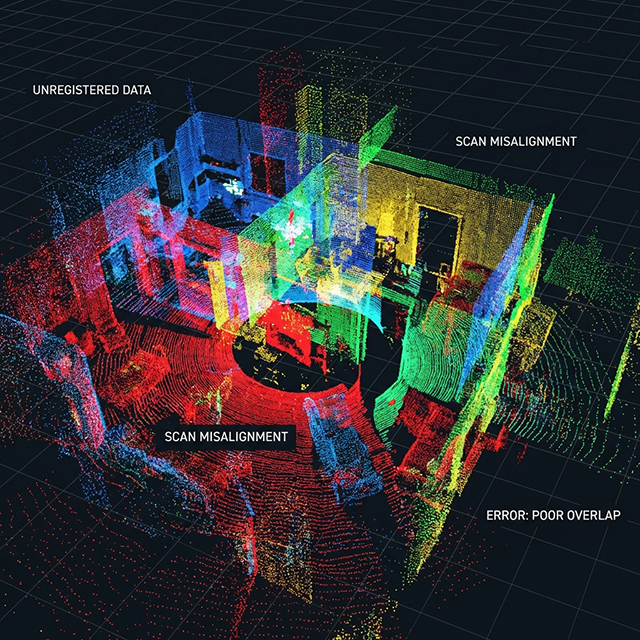
Raw scan data is essentially unorganized chaos and contains millions of individual measurements waiting to be structured.
Processing is where you:
- Convert proprietary scanner formats into workable point cloud files
- Apply initial filters to remove obvious noise and outliers
- Organize scan positions and prepare for alignment
This stage is mostly technical, but it's also your first quality control checkpoint. If your scans have issues (poor lighting conditions, reflective surfaces causing artifacts, or insufficient overlap) you'll discover them here.
Pro tip: Build processing time into your project schedule.
Stage 3: Registration
 Each scan position captures reality from its own perspective. Imagine standing in one spot and looking all around. That’s what the scanner is capturing.
Registration is the process of stitching these individual perspectives into one cohesive, georeferenced cloud.
You have two main approaches:
- Target-based alignment: Using physical reference targets (spheres, checkerboards) placed in overlapping scan areas. More setup time in the field, but faster and more reliable processing.
- Cloud-to-cloud alignment: Software identifies common features between scans and aligns them automatically. Faster in the field but requires more processing power and manual verification.
The reality? Most complex projects use a hybrid approach.
The critical mistake I see: Teams that don't verify alignment accuracy at this stage. A 2-3mm misalignment might seem trivial, but when you're working on mechanical systems or structural analysis, those millimeters compound into serious problems downstream.
Always run alignment reports. Always verify against known dimensions. Always.
Stage 4: Point Cloud Cleanup
- Temporary construction equipment that's no longer there
- People who walked through during scanning
- Atmospheric noise and scanner artifacts
- Vegetation that obscures the actual structure you care about
Cleanup is part art, part science. You're making decisions about what matters for your project deliverable.
For an as-built documentation project, you might remove all temporary items but keep permanent fixtures. For a facilities management application, you might segment the cloud by building system (structural, MEP, architectural) to enable different teams to work with relevant data only.
The time investment here pays dividends. A well-cleaned point cloud means:
- Faster loading and manipulation for end users
- More accurate automated feature extraction
- Cleaner conversions to BIM models
- Smaller file sizes for sharing and archiving
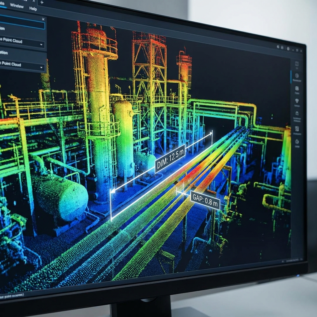
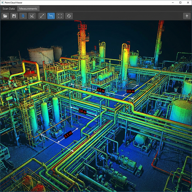
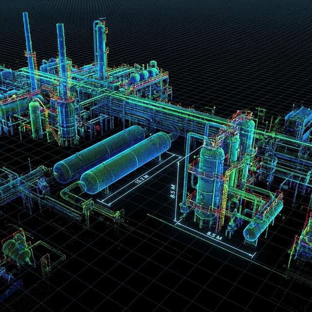
Stage 5: Model Integration and Publishing in viewing platforms
This is where your 3D documentation becomes actionable intelligence.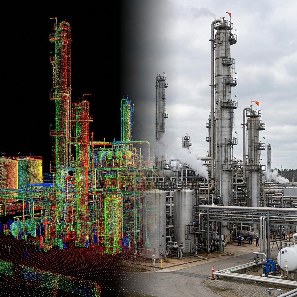
Viewing platforms transform your processed point cloud from a static file into an interactive, collaborative environment where stakeholders can:
- Navigate the space intuitively, even if they've never been on site
- Take measurements and verify dimensions in real-time
- Annotate and markup specific areas for issue tracking
- Integrate with BIM models for clash detection and design validation
- Share access with distributed teams without massive file transfers
Publishing isn't just uploading, it's about configuring the experience for your audience:
- Setting up logical viewpoints and saved views
- Creating measurement tools and annotation layers
- Establishing permissions for different user groups
- Optimizing streaming performance for various connection speeds
Here's what makes this stage powerful: You're not just delivering data; you're delivering context. A project manager in Texas can walk through a facility in New Mexico with a design engineer in California, both looking at the exact same reality-based model, making decisions in real-time.
That's the promise of digital documentation.
The Workflow Is the Product
A rigorous, well-executed workflow produces reliable data that teams trust and actually use. A rushed or incomplete workflow produces files that look impressive in presentations but fail when people need them for real decisions.
Each stage builds on the previous one. Skip the strategic scanning approach, and you'll fight alignment problems. Rush through cleanup, and your published model will be cluttered and slow. Neglect the publishing configuration, and your perfect point cloud will sit unused because it's too difficult to access.
The technology keeps getting better—scanners are faster, software is smarter, platforms are more powerful. But the fundamentals of a solid workflow? Those don't change.
What's been your biggest challenge in 3D documentation workflows? Are you struggling with processing times? Alignment accuracy? Getting stakeholders to actually use the deliverables?
Drop a comment below—I'd love to hear what's working (or not working) in your projects.
And if you find this useful, share it with your network. The more we share real-world experiences with these workflows, the better we all get at turning reality into data that actually matters.
Author: Patrick Champion, PLS
Patrick is a seasoned Professional Land Surveyor licensed in multiple states, bringing more than 25 years of experience across civil, boundary, renewable energy, construction, infrastructure, subdivision, and land development projects.
He has led and executed a wide range of survey initiatives, including large-scale topographic surveys, major renewable energy developments, transportation projects, urban and suburban boundary surveys, ALTA surveys, flood certifications, UAS (UAV) operations, and advanced laser scanning efforts.
Patrick’s depth of expertise and commitment to quality continue to support accurate, reliable surveying solutions for clients in diverse markets.
Texas Survey Firm Registration Number 10020700
1904 W. Grand Parkway N., Suite 200, Katy, TX 77449
888-232-3149