The Land of Impossible. #solved
Got an Itch?
You just can’t scratch that spot in the middle of your back. You know you can get to it – you just need to figure out how.
The same is true in the workplace. A customer may ask you to accomplish something that appears impossible, or your boss may task you with discerning the seemingly unknown. You need to find the right tools to reach that hard to scratch spot.
Overcoming Obstacles
In the industries we serve, projects often involve overcoming tough, physical obstacles. For instance, last year, one of our clients in the mining sector tasked us with not only running title and acquiring specified tracts, but also finding a way to survey and produce high-resolution maps of a mining area riddled with thick vegetation, thorn bushes, and even rattlesnakes. In fact, this project was set to take place just a week outside the rattlesnake roundup (yikes!) for the area. We needed to scratch a hard to reach spot. Here's how we did it.
What’s the secret to reaching those tough spots?
At Percheron, it comes down to three important steps:
-
Get Creative
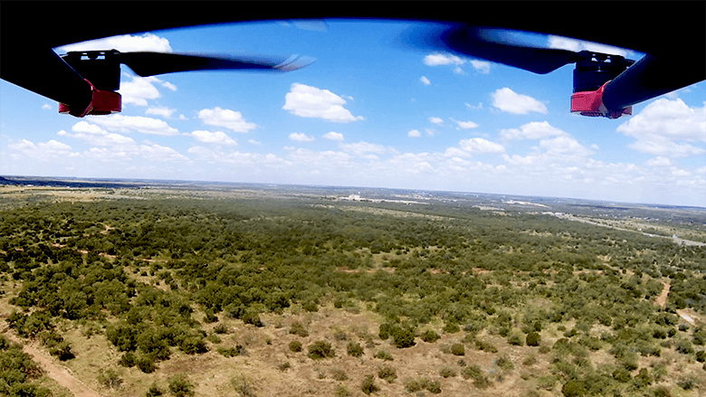
We knew our survey team could handle the mining project. We also knew, however, that surveying this treacherous, rattlesnake-ridden area would involve using machetes to chop through thick brush, jeopardize our crew's safety, and take many weeks to complete. So, we got creative. We enlisted our drone team.

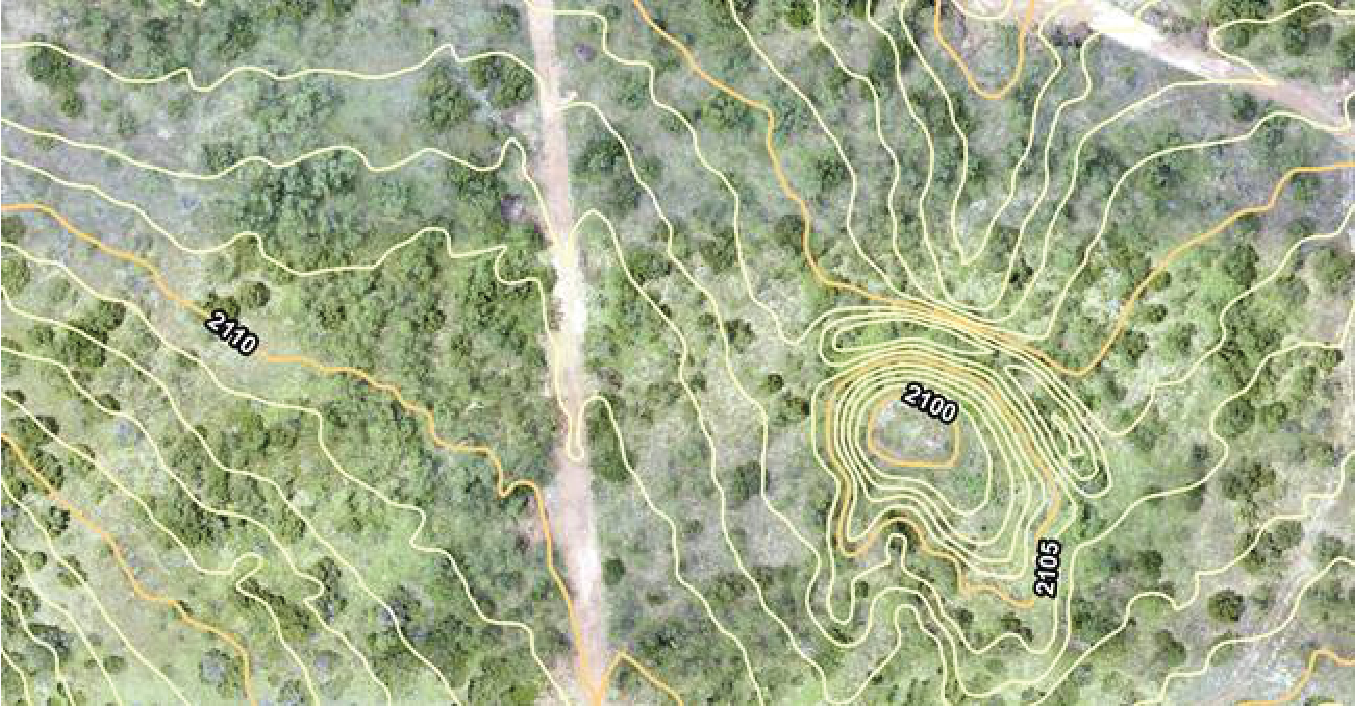
Utilizing an innovative Riegl airborne scanner attached to the bottom of one of our larger drones enabled us to make a complete survey of the project area collecting even more coordinates than traditional surveying – which meant greater accuracy. Flying like a lawnmower over the area enabled us to reduce the need for survey crews on the ground to less than one-third of typical surveying efforts. By using the airborne scanner with a drone, we were able to fly this densely vegetated area and create the detailed maps our client needed, while also saving our customers both time and money while keeping our employees safe.

Images of point data collected by the UAV LiDAR unit over the 600-acre tract.
We provided additional insights to our customer by using drones and photogrammetry techniques to measure the volume of the above-ground stockpiles of the product made by the customer. As the customer added more product to their piles, we used our analytical software to determine how much product was gained and compare it against the product that may still be in the ground. Our creativity enabled us to measure – or reach – a tough spot.

2. Work Together
Reaching this tough surveying spot required more than just flying our airborne laser scanner. We needed to enlist our integrated services. Our dedicated HSE crew worked to ensure that everyone involved understood and followed the applicable mining safety standards and wore proper protection to guard against rattlesnake bites. Our survey team worked to use the high-resolution maps produced by the airborne laser scanner to create ALTA surveys and used reduced, traditional survey efforts to create Boundary surveys. Our title group also chipped in by pulling deeds with descriptions that could be used in creating Boundary surveys. Additionally, our drone team helped our survey group with their Boundary surveys by locating above-ground structures and features in both a fast and accurate manner. By working together, we were able to provide our client with multiple solutions all stemming from a single source – Percheron.

3. Increase your Expertise
At Percheron, we know that expertise is paramount. As working a mining field was fairly new to us, we wanted to ensure that our team understood the unique safety requirements involved. So we sent our survey team, along with our HSE group, to obtain MSHA – Mine Safety and Health Administration – certification. To gain MSHA certification, our crew went through a rigorous, hands-on training requiring 24-course hours. Through this training, the Percheron team learned how to stay safe while working in mines, which enabled us to ensure we met our customer’s needs.
“At Percheron, it’s our people that make the difference.”
Scratching that hard to reach spot is tough, but once you do, all the effort is worth it. By getting creative, working as a team, and upping your expertise, you too can reach that spot and feel the relief of accomplishing that difficult task.
If you want assistance reaching those tough to scratch spots, you can contact us at 832.300.6400.
Happy Scratching!

Written by Arch Stout, Vice President - Survey | Percheron
Arch has been a licensed land surveyor for the past 32 years. He is a Registered Professional Land Surveyor (RPLS), member of the Texas Society of Professional Surveyors (TSPS), the National Society of Professions Surveyors (NSPS), and a combat veteran of the United States Army. He previously served as the Assistant Manager of Survey for Wood Group Mustang Engineering and was a founding partner of Costello, Inc., a Houston civil engineering firm. His career afforded him the opportunity to live across the country and spend 4 years working in the oil and gas industry in Saudi Arabia. Arch is well versed in all aspects of boundary, design, and construction surveying.
