Project Tools
When it comes to project technology to support your land services needs, one size doesn’t fit all. That’s why Percheron offers a cohesive solution for projects both big and small. Percheron has the ability to support your technology needs at all levels.
Land
GRID ties together Percheron’s database system (provided by Canyon Digital’s CityVerse) with our mapping system (provided by ESRI’s ArcGIS Online).
GRID Viewer utilizes the ESRI ArcGIS Online Webmap applications, in combination with our database and reporting tools, we can provide a one-stop-shop for viewing, tracking, and reporting.
GRID Database, powered by Cityverse, is a web-based database that allows users to assign tasks, manage workflows, and automate document generations. GRID is the perfect solution to create, retain and manage your documents from the start of your project through managing the asset long-term. The database integrates with ArcGIS online to provide project information at a parcel level with various basemap details. Our advanced reporting/analytics tools tie together the data from Cityverse and ArcGIS Online to provide our clients with the most comprehensive view of their projects.
Engineering
The Engineering team utilizes Technical Toolboxes, PIVVOT and Omega PIMS to manage projects, tracking and provide quality deliverables to our clients.
Technical Toolboxes is a leader and innovator for various Pipeline Engineering software solutions throughout the oil & gas sector. The platform houses various software applications that cover the full pipeline life cycle process from conception to design, construction, commissioning, operations, maintenance, and integrity. As with other TT calculations and reports, the HDD Module calculations are accepted by regulatory agencies throughout the US regarding Drilling Fluid Management and Hydraulic Fracture Analysis.
PIVVOT platform streamlines siting, suitability analysis routing and permitting with location intelligence. The platform provides continuously updated data including: boundary, geotechnical, hydrology, land use and property ownership, energy, and infrastructure, jurisdictional, community and society, and ecology. With this up-to-date information, facility siting and utility routing tasks are performed in hours instead of days.
Omega PIMS document control tool allows for each discipline to markup drawings, progress, maintain, save each “layer” or revision of each deliverable. All Percheron employees have access to PIMS, as well as client’s Project Manager to allow update and review documents. PIMS also provides Project Controls overview of the cost, progress and manpower on the project. PIMS utilizes the document progress to develop earned value management estimates.

Survey Technology
By Utilizing Leading-Edge Software, Equipment, and Technologies—Percheron Helps Ensure Accuracy, Efficiency, and Greater Project Precision.
Our survey team utilizes several industry-standard equipment platforms, software suites, and tools to execute projects, including Autodesk AEC Design Suite, BlueSky, Global Mapper, Forefront Design Specialist - Plat Mapper, etc. We also use several in-house customized tools to help automate workflows; these tools cover a wide spectrum of survey services and deliverables.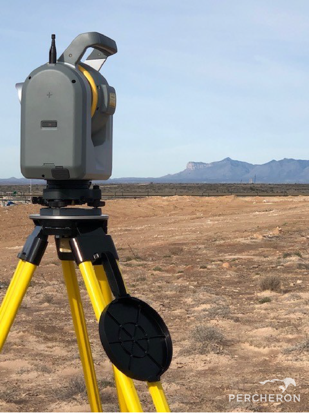
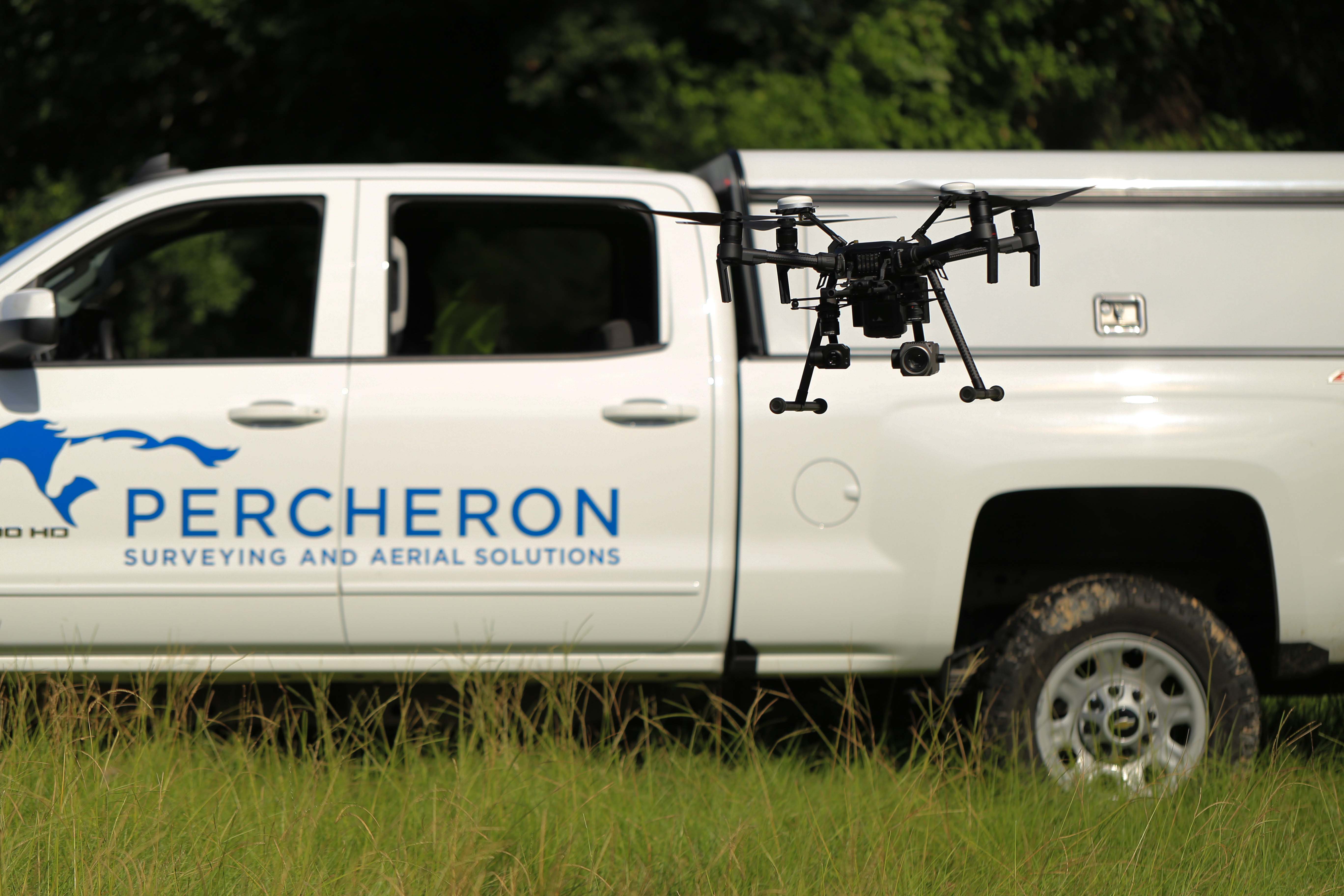
- Field Crews: Percheron field crews are outfitted with state-of-the-art equipment, including Trimble model R10-12 receivers, Radios Detection RD8100 pipeline locators, Reflectorless total stations, and all other relevant equipment to provide the full range of field services. We have several terrestrial scanning capable crews outfitted with the latest laser scanners and hybrid camera scanner setups and dedicated UAV crews to capture all aerial survey and inspection needs.
- UAS and Scanning: Percheron's Aerial Imagery team utilizes industry-standard software suites depending on the application, including Pix4D Capture/Cloud//Mapper/Survey/and Inspect, Trimble Business Center, Bentley MicroStation and Terrasolid, Global Mapper LiDAR, Trimble RealWorks. Percheron uses a wide range of sUAS platforms and manufacturers based on client needs, including quad and hex copters as well as traditional fix-wing UAVs and VTOLs. We also use Riegl and Phoenix aerial LiDAR sensors, full-frame Sony RGB cameras, 200x zoom inspection cameras, FLIR thermal cameras, and SlantRange and MicaSense multispectral, etc.
- Mapping team: Our mapping team utilizes a variety of programs to ensure the highest quality deliverables to each of our clients.
- Trimble Business Center, a Trimble field to finish Survey CAD software, helps deliver high-accuracy GNSS data.
- AutoCAD Civil3D, an Autodesk software that allows 2D & 3D design. This allows us to produce construction drawings, property plats, permits, and site-specific drawings.
- Skyline, a Bluesky software that creates accurate alignments sheets, with a Microsoft Access Database to accelerate workflow and makes changes faster.
- DASH a Bluesky software paired with a data management tool. This software includes QA/QC tools that ensure the reliability and verification of the data being collected. Orbital's Survey Module is a Bluesky software that streamlines pipeline survey management by helping to maintain quality, budget, and schedule without creating extra work for field crews. You can immediately evaluate imported data and track trends to know exactly what the survey teams are doing in the field. It allows you to set time and delivery expectations, track and assess data, and keep communication streamlined in real time.
- Plat Mapper a Forefront Design Specialist software that allows multiple plats to be cut at once for faster plat production.
- Global Mapper is a BlueMarble Software with abundant GIS tools for data creation, editing, and analysis.
- ArcMap, an Esri software with abundant GIS tools for data creation, editing, and analysis, allows the creation of quality drawing deliverables.
Environmental
Our team of qualified specialists provides environmental services and in-depth knowledge of federal, state, and local level environmental regulations for energy and infrastructure projects from the conceptual design and planning stages through construction, operations, and closeout. We work with our clients to ensure solutions that will address your project’s environmental and permitting needs. Our experience gives us the knowledge and foresight to expedite and streamline the environmental permitting process to ensure the commencement of construction of your project on time and on budget.
Neil Shultz

Neil C. Shultz, P.E., PLS is Survey Manager for Percheron, LLC. Neil joined Percheron in August 2018 with over 20 years of experience in the engineering and surveying consulting industry, serving as Regional Manager for the Northeast. Neil previously served as Senior Project Manager for a surveying consulting firm in Pittsburgh, PA. Prior, he served as Project Manager for multiple engineering consulting firms and owned and operated his own boundary surveying firm. Neil holds a B.S in Civil and Environmental Engineering from the University of Pittsburgh. Neil is a Registered Professional Engineer in CO, LA, MI, MT, NM, OK, PA, TX, and WV. He is a Registered Professional Land Surveyor in AL, AR, DE, FL, KS, KY, IA, ID, IL, IN, MD, MI, MO, MS, NC, ND, NE, NM, OH, OR, PA, SD, VA, WA, WV, and WY.
Billy Greathouse

Billy Greathouse is Project Manager - Survey for Percheron with over 20 years of surveying experience, with the last 10+ years focused on new pipeline and facility development as well as O&M. At Percheron Billy is key in new project development and execution, as well as project coordination and management. Billy is experienced in all aspects of land surveying including preliminary, construction, and final as-built for various types of oil and gas projects. He is also well versed in civil topographic surveying, engineering design, route design, ALTA/ACSM Land Title, boundary, and all aspects of plant and refinery surveying. He is experienced in coordinating and managing multiple projects and field crews, safety personnel, on projects both large and small.
Michael Muallem

Michael Muallem is Mapping Manager - Survey for Percheron with over 11 years of surveying and mapping experience, 6 years of mapping lead and coordinating experience. Michael is experienced in many types of survey and engineering including pipeline, topographic, route, construction and As Built. He worked as a Survey Tech/Mapper which gave him experience Processing Survey data to drawing Footprint, Alignment Sheets, HDD, Bore design, Plats, Permits and site specifics. Michael holds an Associate’s Degree at Tarrant County Community College and is BlueSky Certified Level II.
Patrick Curlin

Patrick Curlin is Mapping Lead - Survey for Percheron with over 26 years of experience in pipeline route design and mapping. He is experienced in coordination, personnel, for both small, fast-paced, multi-state projects and large, multi-year, long linear projects. He serves as mapping lead for select projects throughout the nation. In addition, he has extensive technical skills in different CAD programs. Patrick is Blue Sky certified Level II.
Jeremiah O'Dean

Jeremiah O’Dean, PS, LS is a professional land surveyor with over 16 years of survey experience in oil & gas, transportation, power generation, subdivision and land development for public and private entities. He has experience in the oil/gas and power generation market sectors and is extremely knowledgeable with various types of surveying equipment and field surveying procedures, survey data adjustments, courthouse research, topographic surveys, ALTA/ACSM Land title surveys, Boundary Retracements, preliminary/as-built pipeline surveys, and various CAD & GIS mapping applications. Jeremiah is a Registered Professional Land Surveyor in CA, FL, GA, ID, KY, LA, MD, MS, NC, ND, NM, NY, OK, PA, SC, SD, TN, UT, VA, WI, WV, and WY.
Liborio Salinas

Liborio "Libo" A. Salinas, Jr. is a Managing Director for Percheron, LLC, with 14 years of experience in the energy industry.
Libo began his career as a Petroleum Landman, reviewing title for mineral ownership, preparing leases, providing due diligence, preparing right of way agreements, and completing lease packets. He joined Percheron in 2011 as a Petroleum Landman in the Eagle Ford Shales. He began working as a Title Agent and Right of Way Agent and was promoted to an in-house Title position, first as a reviewer and subsequently as Title Supervisor. In 2017, Libo took the position of Regional Manager, South Central - Field Services, overseeing multiple major midstream pipeline projects, as well as managing an extensive integrity program for one of the largest all-natural-gas distribution companies in the region.
Libo served on Percheron's internal safety committee, helping to develop and implement various employee safety initiatives, including wristbands to promote safety awareness and Percheron 360°, encouraging employees to conduct a 360° walk around their vehicles before entering the vehicle.
He is an active member of the American Association of Professional Landmen (AAPL) and International Right of Way Association (IRWA) and holds a Texas Real Estate License.
Gwen Longo

Gwen Longo is a Program Manager for Percheron, LLC. She has 9 years of experience working in the energy industry, previously serving as Regional Manager, Northeast. After receiving her Bachelor's degree from Slippery Rock University of Pennsylvania, Gwen began her career as a GIS Technician and was promoted into project management in 2016. She has been involved in the right of way process from beginning to end; from initial routing design with engineers, building property boundaries with title, document generation and review, easement acquisitions, landowner and attorney negotiations, construction support, reclamation, and project closeout. Gwen is an active member of the International Right of Way Association (IRWA).
Members